Showing posts with label adventure. Show all posts

Saturday, August 21, 2010

Scott'sSuper Secret Birthday Aventure (Part 2)

So last year was pretty cool.

This year was awesomer.

We rented a car and started driving south. I had no idea what we were doing or where we were doing it, so navigation was a bit tricky. This was especially difficult, since Google Maps used different road names than the signs we saw.

However, after only a couple of wrong turns, we made our way to Adventure Waikato.

After a quick bite of lunch in the car, we met Simon, our guide for the day (he also owns the farm and Adventure Waikato). He gave us the slightly scary safety briefing (i.e. - "If something happens to me: this is where you need to go to get a cellphone signal, here are the GPS coordinates to give the 111 operator in case they need to get a helicopter, etc."), and then got us in our gear. After last year's adventure amongst the trees, I had a rough idea of what was in store when we put on our harnesses and helmets.

However, since I have never abseiled before (that's repelling, for those of you in the US), I didn't really know what was actually in store for us.

We walked through a couple of sheep fields to get to the top of a cliff. The farm on which Adventure Waikato is located has an extensive series of caves underneath it. A while ago (geologically speaking), the roof of part of these caves collapsed, leaving a deep valley.


Simon showed us how to tie the knot that would allow us to control our descent down the cliff face, then went part way down himself to be near the drop off point. I went first and was doing fine until I got to the vertical part of the cliff face. I found out the hard way that slippery rocks are slippery. Here are before and after photos as proof of my experiment:


I banged my knee on the rock face when I slipped. It is going to be stiff and sore for a while, but no permanent harm done.

Jen came down after I was safely at the bottom:


Here we are down at the bottom of the cliff, only slightly worse for the wear.


Once we were down, having both spent a portion of the trip down just sliding down the rock face on whatever part of our bodies happened to be there, Simon came down and showed us how to do it properly.

We then set off on a very cool trek through the bush at the bottom of the valley. There were a couple of rope/cable bridges that we got to cross (our experience from last year's event was extremely valuable).


There was also one point that we had to climb through a small tunnel under a rock fall. At this point, Jen was feeling bad about me hurting my knee and heroically threw herself down onto some underwater rocks to get a sympathy injury while we were crossing a pool of water at the bottom of the tunnel. She also managed to get soaked from the waist down, but kept the camera mostly dry.

At the end of the walk through the valley, we got to one of the cave entrances. Inside we found some amazing stalactite and flow formations:


This cave is also home to a colony if New Zealand's famous glow worms, whose fishing lines you can just make out in this picture:


One of the flow formations was looked a bit like a pipe organ, and, in fact, had some cool acoustic properties as well. This video doesn't show much, but it is Simon tapping the bottoms of the rock pipe with a carabiner:


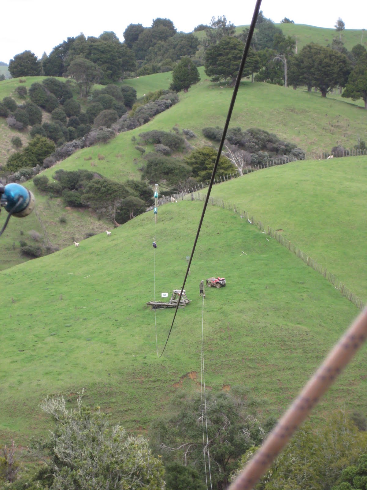
After emerging from the cave, we climbed up to the top of a hill for our trip through the valley's grand climax: a flying fox. It was quite a lot of fun, even the bit where you go through the top of a tree.


Now, at this point, I thought we were done. I was wrong. There was more, and it was cool.

Jen had also signed us up for a run on their orienteering course. Simon gave us a compass, a list of bearings and clues and sent us on our way (after briefly explaining how to use the compass). That was a great deal of fun. We ranged all over the beautiful farm and got to see some amazing scenery.


We even finished before dark!


We were on the road as dusk was settling in and tried to make it back to the highway before full dark arrived. We did not quite make it, but we didn't have a whole lot of trouble finding our way back.

On our way home, we stopped at a place called Pokeno Bacon for dinner. It was everything it promised: every dish had bacon in it. Sadly, it was NZ style bacon, instead of American style bacon. However, it was still pretty good, though the macaroni and cheese was a little light on the cheese.


All in all, this was a fantastic weekend adventure. Jen and I found some new bruises and sore places this morning, so we knew that it had been our kind of adventure.

Tuesday, April 6, 2010

Easter on Mt. Taranaki

Here in New Zealand, Easter is a four-day weekend (Good Friday and Easter Monday off). So, Jen and I decided that it had been far too long since we had inflicted a session of horrible, multiple-day misery upon ourselves for the sake of getting something to post on this blog. The resulting plan was to prove our muchiness with a four-day tramp in Egmont National Park, home to Mt. Taranaki:


View Mt. Taranaki in a larger map

We left Auckland in reasonably good time, but got tied up in traffic, so we ended up getting to the Dawson Falls Visitor Centre a little later than intended. This was not a problem, as we only had a an hour and a half hike to get to our hut for the first night. With plenty of time to spare, we decided to go take the five minute detour to see the falls, which were quite pretty:


Unfortunately, the falls were at the bottom of a ridiculously steep set of stairs in varying levels of disrepair. We also discovered that we had done a poor job of packing (heavy stuff should go on the bottom), and both of us were in a fair amount of misery right from the start.

Fortunately, this was a very short hike and we were soon treated to some spectacular views of the mountain from the deck in front of Waingongoro Hut. There was only other person at the hut that night: Brian, from San Diego, who was three weeks into a year-long trip around the world (we were very jealous). We shared tramping horror stories (his were much better) and found out that he was going to be going to the same hut we were on the following evening.


That night the sky cleared and before the moon came out we were treated to a truly spectacular star-scape. We live in the city, so our star gazing is normally limited to a handful of the brightest that manage to break through the haze and the light pollution. It is good to get away sometimes, to be reminded that there is a cost to living with the conveniences of modern life. Sadly, our trusty, loyal point and shoot camera was not up to the task of capturing the night sky, so you will just have to take our word for it.

The following morning, we had our first successful experiment for the weekend: bacon for breakfast. On the last morning of trip to Kai Mai, some other people in the hut had freshly cooked bacon for breakfast while we worked our way through some freeze dried yogurt and muesli. We thought, at the time, that that was particularly cruel and unfair of the other trampers and so decided to bring our own this time and see if it would work out well. It did. The only downside was the bacon grease at clean up time, but that was only a minor inconvenience compared to hitting the trail with bacon power fueling your hiking.

After breakfast, we completely repacked our backpacks. Heavy stuff goes on the bottom, light stuff on the top. Heavy stuff goes in Scott's pack, light stuff goes in Jen's pack. This took a fair amount of time, but was well worth it in terms of making the rest of the trip survivable.

We rolled back into the Dawson Falls Visitor Centre around 12:30, had a quick lunch and dropped of the previous night's rubbish in the car. Since the visitor centre was open now (we got to the park after it closed on Friday), I went in to ask about how difficult it would be to summit. You see, the plan was to head up to Syme Hut, which was above the scrub line on one of the secondary peaks of Mt. Taranaki.

The girl working the counter helpfully told me that it was about two hours each way from Syme Hut, but that it was a pretty difficult route and there was no marked trail. There was optimistic talk about waiting until the morning to see what the weather was like (as there is little point in summitting if the mountain is covered in clouds). We set off on the trail and made pretty good time. The trail was fairly relentless in its insistence that we were not high enough, and so a vast majority of the time we were heading up hill.

We were amused to find this bench, with a very picturesque view of the mountain. The Kiwis are very proud of Sir. Hillary, as you can see:


Or, as Brian rephrased that evening:
Pause for a moment, to bask in the awesomeness that is Sir Edmund Hillary
And here is Jen looking joyous at the prospect of more "up":


The problem, you see, is the stairs. The combination of steep slopes and heavy rain fall means that there are steps built into all of the trails on Mt. Taranaki. The steps are usually irregularly spaced and rather high: anything from a 6 to 18 inch rise on each step. The portion of the trail that we were on was pretty much exclusively steps. Steps that went on for a very long time. Jen started counting after a rest and got up to 1736 before we got to the top of the last set of stairs.


We rested briefly at the top of the stairs before heading up the mountain, into the cloud. This is pretty much the next kilometer and two hours of our lives:


That post that is sticking out of the ground next to me was one of the trail markers up the scree field. They were few and far between and helpfully colored light grey, which was good for picking them out of the haze against a grey rock backdrop. There were several occasions when we could not actually see the next marker, but had to proceed on anyway, as daylight was burning.

Several people passed us going down, and, in typical Kiwi fashion, kept giving us terrifically useful information such as "oh, it's just a wee while more!" and "don't worry, you'll make it before night fall". Thanks. At one point, we had to have one of the kind people going down the mountain take my water bottle down to Jen, as she was out and I had all of the reserves (as water is heavy).

So, after two hours of the most difficult, physically draining anything we have ever done, we made it to the top and received our reward:


Syme Hut itself was quite cozy, with eight of the ten bunks filled, but not too crowded. Everyone was in good spirits that evening as we prepared our dinners. While we were waiting for the water to boil for our freeze dried meal, Brian, whom we had met the previous night at Waingongoro hut, shared with us his recipe for the best food ever:
Start by walking for 6 hours, and then pretty much anything will do

After dinner, we bore witness to the sort of spectacular sunset that is common up on a mountain above the clouds.


You may have noticed in the pictures of Syme Hut that it is, in fact, bolted down with guy wires. This is not a coincidence, as the wind was quite strong. So strong, in fact, that the wind howling across the rocks and around the hut made sleeping quite difficult.

The next morning was cloudy and windy. Jen and I had both reached the same obvious conclusion about our prospects at attempting the summit: it would be really stupid and we might die. Not, "oh that was really hard, I almost died!" No. The actual physical, clinical death that would result from being blown off a mountain top by a 70 mph gust of wind and getting several seconds of free fall before contributing to the scree field in a spectacular, if slightly messy, fashion.

So, we set off down the mountain.

Now, naive hikers might think that down is easier than up because "gravity does all the work". It turns out that gravity is sometimes a little over eager in its assistance and has the pesky habit of throwing unwary hikers down onto the ground when they loose their balance.

I had only a couple of spills on the scree field, resulting in minor abrasions to my hands and a sore shoulder. Poor Jen, though, did not fare so well. Her legs were still shot from the previous day's exertions, and so she had a great deal of trouble keeping her balance on the poor footing. She spent a great deal of the journey sliding down the slope, riding a small, controlled avalanche. There are some pretty spectacular bruises, but we will spare you having to see pictures of them.

After we finally got down out of the scree, we had just a couple of dozen stairs to get down before we got to the point where we had to make a decision: continue with the plan and go on to Lake Dive Hut or head back to Dawson Falls, the car, and go home a day early. It was not an easy decision, but in the end we decided that we would likely not be back to Mt. Taranaki and so decided to continue with the plan.

It turns out this was a pretty good choice, as the next couple of kilometers of trail was a very cool walk around the side of the mountain, above the tree line and through tussock grass. This got us some great views of the surrounding country side before the clouds set in for the afternoon.


Sadly, the pleasant part of the track had to end eventually, and we started descending the mountain. This, of course, meant more steps. Going up a couple thousand steps leads to some huffing and puffing, burning thighs, and a lot of expended energy. Going down a couple thousand steps leads to some huffing and puffing, a lot of expended energy, and some pretty sever knee abuse. Especially when wearing packs.

It took us much longer than we wanted to, but eventually we made it to Lake Dive Hut. This was the swankiest hut we stayed at this trip, with indoor running water and a wood/coal stove for heat. We spent an enjoyable evening sitting in front of the stove, playing cards with the other trampers.


We got out to a relatively early start Monday morning for what we supposed would be a relatively easy hike back to Dawson Falls Visitor Centre. It turns out we still need to work on our topographical map reading skills, because it was a pretty rough trail. At least it was not the monotonous trudging up or down slope for hours on end. No, instead it was a good, even mixture of up and down, with a couple of interesting river crossings thrown in for fun. Also there were a couple of places where the "slope" became more of a "wall" and we had to climb up and down some interesting wooden apparatuses to continue on our way.

I think my favorite was the stream crossing where we had to climb up the river about 10 meters before getting to the place where the trail continued.


Progress was slow, and we took an hour longer than the "suggested" time to get back to the car. We were somewhat concerned about the time because we had agreed to help ferry some of the other trampers we met at the Lake Dive Hut from Dawson Falls to their car at North Egmont (another 4-5 hours on foot). Only one of them was there waiting for us, but she had all three of their packs. The rest had decided to continue on to North Egmont on foot.

We dropped her and the bags off at the entrance to the park by North Egmont and got on the road, for a beautiful drive through the New Zealand country side.

We were exhausted, bruised, and sore.
We were exhilarated, content, and happy.

Sunday, January 17, 2010

Jen and Scott's Tramping Trial

This last weekend, Jen and I had our first tramping experience at Kaimai Mamaku Forest Park.

This map shows roughly where we went, color coded by day.


View Jen and Scott's Tramping Trial in a larger map

I want to get three things out of the way before describing our weekend:
  1. "Tramping" is the Kiwi term for "Backpacking".
  2. Yes, we are going tramping again.
  3. Yes, we are insane.
Good, now that we have that taken care of, onto the stories.

Jen did most of the planning, which was good, as the planning had to take place when I was busy working the evenings and weekends before Christmas due to complications at work. She found an outdoor equipment store that both employed people competent in their field and rented out equipment. Those are both important as we did not really know what we needed and could not afford to buy two full sets of tramping gear outright. It turns out that tramping is one of those hobbies on which one can spend a near infinite amount of money (which is deeply odd, to my mind, as the whole point of tramping is to "get away from it all").

Friday morning rolled around and we did some last minute packing, picked up the rental car and the rental gear (from different places, obviously) and got on the road not a whole lot later than planned. We had a lovely drive through some of the rolling fields of the North Island, despite some initial traffic due to a huge concert taking place less than a mile from our house. After a bit of a delay due to a navigational error on my part, we made it to the car park at the trail head.

We tied on our boots, strapped on our bags, locked the car, and headed off into the sheep pasture. It seems a bit odd to me, too, to have huge national parks that do not have public road access, but it is apparently a fairly common arrangement (we found the same thing in the Otaika Valley). So we trudged through several fields, with our packs beginning to weigh heavily on our minds and backs. My pack, while heavy, was not giving me too much trouble, as we had the person who rented it to us help me adjust it so that it was properly sitting with most of the weight on my hips instead of shoulders. Jen, however, had her own pack from her Africa trip, and so did not have any professional help in adjusting things. She was loosing feeling in her legs and her shoulders were being squeezed by the bag.

Now I know some of you are smirking right now, thinking to yourselves "It's just a backpack, how hard could it be to adjust?" Well, the answer is: quite hard, thank you. Jen's bag has approximately 47,291 straps, some of which you can clip into other straps and some of which just have a length adjuster. After futzing with things for a couple of minutes and nearly killing her twice, we got it to the point that she could survive until we reached the hut at which we were planning on staying the night.

Three hours of moderately difficult hiking later (made more difficult by our being unaccustomed to the full packs), we made it to Dalys Clearing Hut, which was actually much nicer than I thought it was going to be. It has bunks for approximately 16 split between two rooms, a small common room/kitchen and a potable water supply. It also had some other guests for the evening: Robby, Jo, and an indeterminate number of children (our best estimate is 5±1.3).

Jen and I shed our packs and boots as quickly as possible, profusely thanking whoever first recommended that we bring sandals or flip-flops to wear around camp instead of our boots. Dinner commenced, then, at a picnic table in the grass in front of the hut. It turned out to be dinner time for some of the local insect life as well, as both of our feet got munched on by bugs (Jen now sports thirteen angry red bites on her feet and I have forty-nine). After a bit of perhaps unwise stubbornness to "not let the bugs win", we finished dinner and our card game and headed to the hut to settle in a bit.

We spent the evening chatting with Robby and Jo. They are locals who apparently go tramping with some or all of their kids just about every weekend. We traded outdoor adventure war stories and they complained about Aucklanders (we were given a pass, since we are also foreigners), who apparently have a reputation throughout the rest of New Zealand as being rude and conceited.

Robby, being an avid hunter of pigs, goats, and possums, had some particularly amusing stories of Aucklanders' reactions to seeing his hunting riffle. Apparently people who do not grow up in a hunting culture get a little freaked out about that sort of thing. Who knew?

After a couple hours of highly entertaining conversation, we headed to bed, as Saturday was going to be our long day.

We got up a little after dawn and were sitting on the porch eating our breakfast of freeze dried muesli and yogurt (which was quite good - lots of dried fruit), when we were surprised to see three dogs trot happily into the clearing and start sniffing around. They were obviously not strays, as they looked quite well cared for and each had a thick leather collar about 5 inches wide protecting their necks. They were followed in short order by their people, who were out for a little Saturday morning pig hunt. They did not stay long, though, and shortly headed down the trail, following their canine companions.

We were not far behind, as we were planning on hiking approximately 7-8 hours that day. There were going to be a couple of river crossings that we would have to do, a waterfall to see, and some old kauri trees (old as in centuries-old old) to ogle. We were on the trail by 7:30 and made pretty good progress for the first hour or so, until we got to the first river crossing.

Here, we ran into several problems. The first of which was that, due to a partially fallen and obscured trail marker, we had trouble figuring out where the trail went on the other side of the river. I walked up the rocky river bank for a while, to see if I could find the trail on the other side.

That is where we ran into the second problem: the first of many emergency altitude adjustments. You see, even though I am normally fairly spry when it comes to hopping across rocks, the 35 lbs I had on my back had a substantial effect on my center of gravity and I was not quite used to the additional weight. One unexpectedly loose stone later and I was ponderously falling down.

I now have a fair idea what a tree might feel like as it falls to the forest floor: the toppling of me was not particularly fast, but it had a certain air if inevitability to it. Fortunately, I was spared the trauma of landing on the rocks, as I fell into a bush with very sharp, thorn-like leaves (pictured), which left my forearms a mess of irritated spots. I also received a nice abrasion on the inside my right forearm from one of the rocks. Additionally, I learned a very important tramping survival skill: after one falls, it is best to just unbuckle ones pack rather than try to stand up wearing it. I felt rather like a large, confused turtle, trapped on my back like that. Fortunately, I and my gear were relatively unharmed, my epidermis notwithstanding, and dry, as I was several meters away from the water when I lost my balance.

We finally found the trail on the other side of the river and we started the actual river crossing. As first attempts at river crossings go, I think ours went fairly well. I stayed mostly dry and Jen only got wet up to her knees after slipping on a slimy rock. However, we lost a good deal of time: what should have taken five to ten minutes at most took us the better part of 45 minutes. However, we were not too concerned about the time, and pressed on, up a very steep slope to the kauri grove, where we ate a quick lunch after marveling at the size of the kauri specimens. The pictures we took sadly do not give them justice, since we could not get one of us next to a tree for size comparison. Each was easily 20 feet in diameter.

While we were eating, Robby, Jo, and company arrived, on a day hike just up to see the trees. They asked us if we were still planning to do the circuit that we had described to them yesterday and gave us somewhat skeptical looks when we replied in the affirmative. However, being good Kiwis they did not try to dissuade us.

After lunch we strapped our packs back on and headed down the trail, thinking we were still fairly on schedule when we got to the sign. There were not many signs in the park. Mainly there were small signs at each trail junction indicating what was in which direction and about how long it would take to get there. The sign that we came across indicated that Aninui Falls (where we were headed first that day) was 3.5 hours distant.

This came as a bit of surprise to us, as that entire leg of the days hike was only supposed to take about 4 hours and we were already 3 hours into the journey.

After a few moments of alternating blind panic (there was no other shelter closer than the one we planned to get to that evening) and blind rage (at the ones responsible for the poor information available to us about how long various parts of the trail took to traverse), we struck out again, with a renewed urgency and a deep desire to not spend the night in the bush.

What followed was four hours of hard travel. We each experienced several more emergency altitude adjustments, as fatigue set in and we tried to keep up the pace. Neither of us were seriously injured, but Jen got a pretty good 2-inch gash on her shin from a log and I got a matching bump on my shin from a rock (Jen says the technical term for "bump" is "hematoma"). Fortunately for Jen, we had a first aid kit and we were able to patch her up without much drama. Additionally, there were four or five places where the trail was completely occluded by dead falls. Each of these cost us 10-15 minutes as we had to try to climb through the dense bush around the dead fall and find the trail again on the other side.

We finally made it to the turn off to see the falls, and after a quick bite and drink, ditched our bags and headed down the trail, determined to see what we came to see. After a quick and not too dramatic hike, we came to a sign with dire warnings about slippery rocks, sudden gusts of wind, and the 106 meter drop from the top of the falls to the rocky valley floor. After some careful climbing around, we were slightly frustrated at our inability to see much of the falls. Jen decided go out onto a rock that jutted out over the cliff edge right next to the water to see if that provided a better view.

It turns out that it did:

This picture is pointed straight down. The bit of green stuff you see in the lower left corner are full-sized trees.

After snapping some pictures, we headed back to the main trail to collect our packs and begin what we had been told would be the hardest part of the trail: we would be descending into a gorge. This is where we learned that reading a topographical map that says "The vertical interval between the contours is 20 metres" is quite different than actually descending 160 meters over about 800 meters (that is about 525 feet, or about 50 stories, over a half mile) while wearing full packs after already hiking for 8 hours.

The next 4 hours were a little rough. Jen and I were both in a fair amount of pain from various acute injuries and the general wear-and-tear of the day's labors. We were also trying to hurry, as we were losing daylight and had not a lot of confidence in how long the journey would actually take.

Now, had we not made it to Waitawheta (pronounced wah-TA-feh-tuh) hut before dusk (which we did), we would have had a cold, wet night, but we would have been fine. Each of us had a good sleeping bag rated for far colder temperatures than would occur, we had the means for making fire and hot food, a water filter to refill our exhausted water bottles, extra clothes for warmth, and an emergency blanket and rope with which to make a shelter (hence the 35 lbs. packs).

That being said, however, does not mean that we were not elated to see the Waitawheta hut, with smoke coming out of its chimney and other trampers' muddy gear sitting on the porch. We were welcomed by an extremely friendly and talkative 7 year old, who wanted to know everything-that-we-had-done-and-everything-that-we-were-going-to-do-and-were-we-staying-for-the-night-and-he-went-swimming-today-with-his-uncles-and-did-you-know-that-there-are-deer-here-sometimes. Despite our exhaustion, pain, and frustration, we could not help but smile at the pure joy of a child enjoying himself out in nature, whose only care in the world was making sure that everyone else was having as great a time as he was.

After a quick rinse off outside (we had accumulated some mud during our 12 hour ordeal), I started dinner: freeze dried beef stew with noodles. I am proud to say that not only did I manage to complete the complex instructions of: 1) boil water, 2) pour water into pouch, 3) let sit for 10 minutes, without burning myself, but I also did not set the hut on fire. Again, we were quite surprised at how good the food was. Of course, at that point a handful of mud and leaves probably would have tasted good if it was hot and we got to eat it sitting down without our packs.

Jen was felling a little worse for the wear, so she went to bed straight after dinner, but I stayed up a bit. The rest of the trampers were playing cards by candlelight. I chatted for a while with the ranger who was staying at the hut for a couple of weeks to oversee some trail maintenance. He has been working at Kaimai Mamaku for 33 years and personally cut many of the trails that in the park (including the ones that we had been on that day). His response when I told him where we had gone was fairly typical of all the Kiwis we talked to: "Well, that's a bit of a walk".

When we got up Sunday morning, we discovered yet another rookie mistake that we made when planning the trip: no bacon. We had a camp stove with which to cook our hot meal for Saturday night, but we neglected to take into account how astonishingly good bacon smells in the morning when one is exhausted, beaten up, and looking forward to another hard day on the trails.

After our very sad muesli and yogurt breakfast, we packed up and helped clean the hut before gearing up to head out. That was when we discovered another rookie mistake (this one more serious than our choice of breakfast food): instead of bringing our boots inside to dry next to the wood stove, we left them outside (they were quite muddy and we did not want to track the mud inside). That meant that, not only were my amazing-water-proof-to-the-ankle boots still wet, but they had standing water in them. Ugh. Nothing ruins the simple pleasure of warm, dry, clean socks like having to put on presoaked boots.

Sunday's hike only only took us about 4 hours, all together. It mainly kept to an abandoned tramline that used to be used for logging, so there were no ridiculously steep grades, as there had been on Saturday. There were several river crossings, but by this point we pretty much had the hang of them and managed to navigate them much more quickly than our first. We made it back to the car without much further incident.

Oh, but we did see this neat bug with stick-like camouflage while we were eating lunch:


All in all, it was a great trip and an excellent learning experience for us. We are already planning our next outing.


Happy Trails!

Friday, August 7, 2009

Culinary Experiment 44

Jen is in the kitchen right now making some sort of dessert. I don't know what it is, but it involves more than 4 ingredients, one of which is molten sugar.

I hope we all make it out alive!

Tuesday, August 4, 2009

Pickle Results

So we cracked open one of the pickle containers and the results were: Excellent!

They tasted a little vinegary, and strongly of dill and garlic (which was good). Also the texture was a little squishy, but that was due to the quality of the cucumbers I used, I think.

Anyway, here is the annotated recipe that I used:


2 1-liter jars, cleaned with boiling water
1.8 kg small cucumbers
1 L white vinegar
1 L water
250 g coarse salt
15 g pickling spices
4 garlic cloves
20 g fresh dill

Soak the cucumbers in ice water during the rest of the preparation

Combine the vinegar, water, and salt in a large pot and bring to a hard boil

While the brine is heating, peel the garlic cloves and chop in half

Once the brine is ready, evenly divide the garlic, dill, and pickling spices between the two jars, then pack the cucumbers tightly in the jars.

Pour the boiling brine over the cucumbers until the jars are full.
Seal the jars and store in a cool, dry place for about 2 days.


Notes:

The cucumbers I bought in 600 g packs. I could have easily fit another pack split between the two jars.

I had not quite twice as much brine as I needed. Adding more cucumbers would cut the amount needed by even more.

As I said above, I think fresher cucumbers would have made the pickles crisper.

Monday, August 3, 2009

Culinary Experiment 43.2b

In an attempt to bring some civilization to this savage land, I have undertaken an experiment in a realm entirely new to me: pickling.

Yes, we are sad to report that there is a dearth of dill pickles here, kosher or otherwise.

After a little research on the internet, I improvised a recipe and whipped up a batch tonight. They should be ready for initial tasting in two days. I will report here how that goes.

Thursday, June 4, 2009

Firewood

Last night, right at dusk, a very nice man rang our doorbell with a delivery of firewood for which we have been waiting many weeks. Actually we have only been waiting a week and a half for this order, but there was an order with another firewood company before that that disappeared into the ether and never got filled.

In case you were ever wondering "exactly how much is 2.4 cubic metres of wood?", the answer is "a lot!". It took us about 2 hours to move it all into the shed by hand, in the dark, uphill both ways in the snow, while being attacked by wild, rabid, ninja kiwis (the bird, not the people). The shed is now officially a wood shed, instead of a "not really sure what to do with it, but let's put our rake, shovel, and barbecue in there so it doesn't feel useless" shed.


We tried to get the cats to help, but the feline union held firm on its stance that manual labor is beneath its members, even if we fashioned a little sledge out of bamboo for them.

It is kind of hard to tell in the pictures, but the wood is stacked waist high, three layers deep in the back of the shed. The stuff that looks like firewood is pine, the stuff that looks like lumber is gum (aka eucalyptus).

We tried out the firewood in our fireplace last night and it worked OK, though it was still a little damp. Hazzah! Warmth!